Millerd's Map of Bristol

Inset images
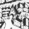
Images of significant Bristol buildings form a border. Click on them or the links below for a full-sized image.
In 1673 James Millerd published the first map of Bristol drawn from a measured survey. Bristol City Museum and Art Gallery sells facsimiles.
James Millerd was a Bristol mercer. He received the gift a of
silver tankard from the Corporation for his plan, described as the
largest, exactest and hansomest that ever was drawn of this city.
The plan was revised and reissued at least four times, in 1684, 1696,
c.1710 and c.1729.


